


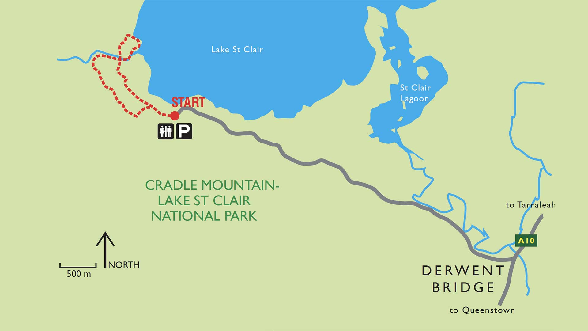
Although not the largest lake in Tasmania, Lake St Clair must qualify as perhaps the most beautiful.
It is surrounded by the forests of the Cradle Mountain Lake St Clair National Park, and back-dropped by the Walls of Jerusalem National Park, the lake is a gem in a lush green crown.
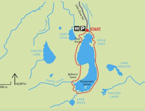
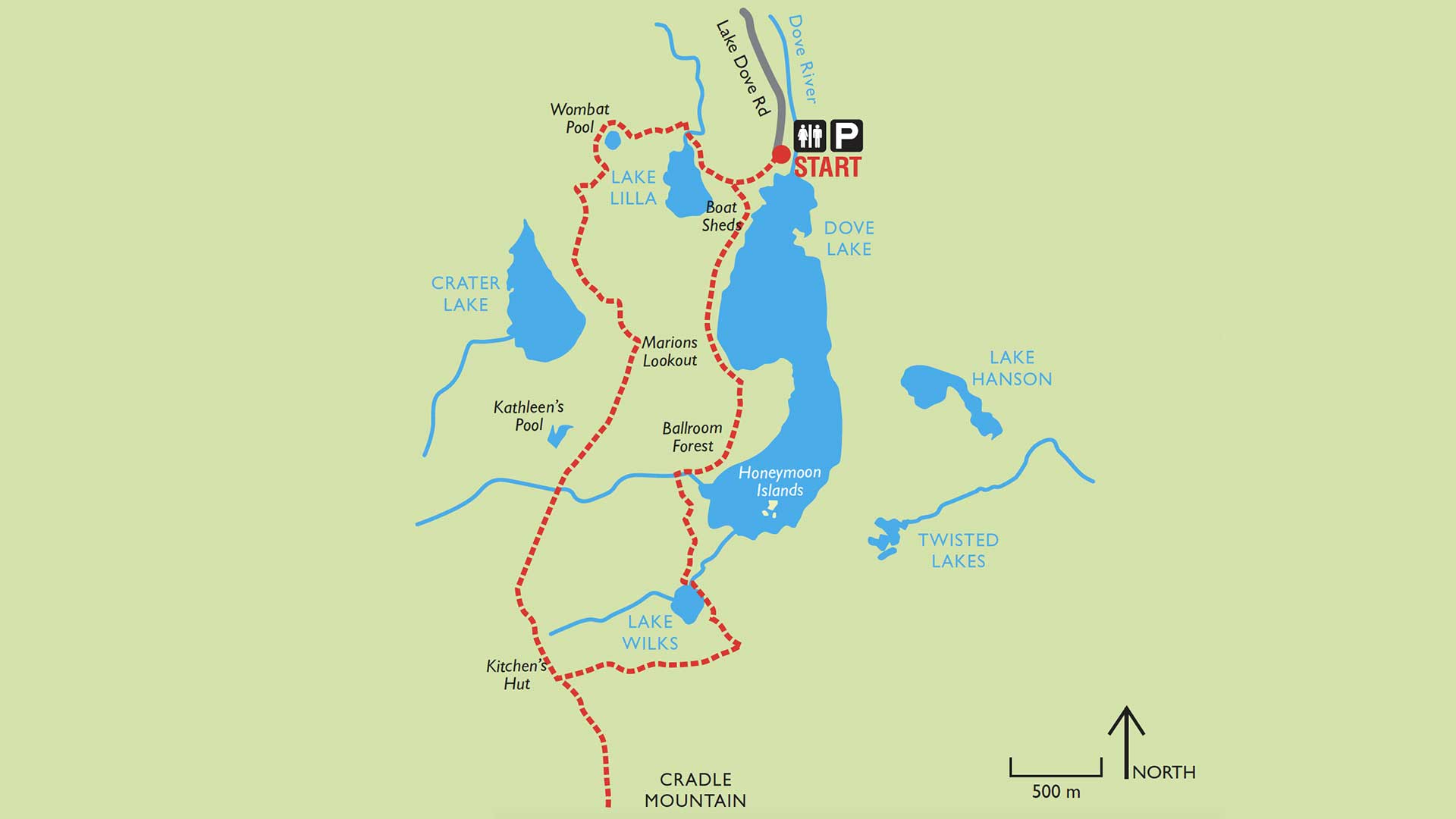
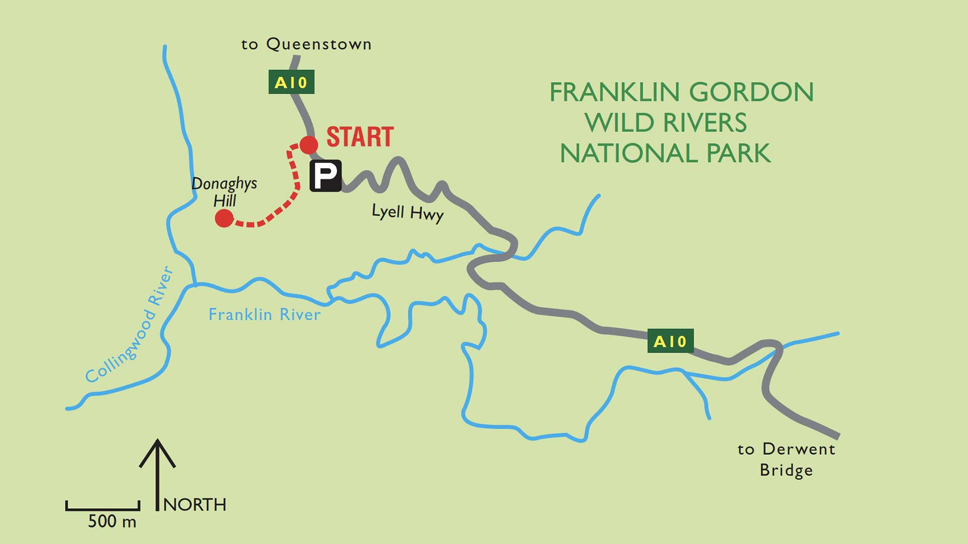
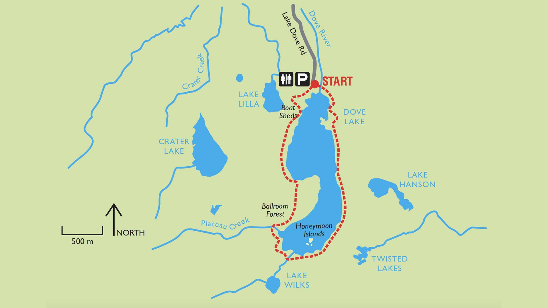
Situated just a few kilometers off the Lyell Highway (A10), there is a choice of 3 short walks waiting to be enjoyed. The shortest of these trails is just 2.4 km return, however, the walking distance can easily be extended by combining this with the other walks – something than many visitors choose to do.
In total, the 3 combined walks form a loose figure of eight that is just a fraction under 5km in length. All of the Lake St Clair walks are rated Level 2, which means that they are an easy walk suitable for most levels of fitness. Level 2 tracks generally have occasional steps and a formed gravel or hardened surface.
As always, walkers should make sure that they have suitable footwear and clothing, including sun hat, sun block, sunglasses along with a jersey or jacket. The weather can be exceptionally changeable with wind, rain and snow occurring in any month of the year.
Walkers should allow up to 1.5 hours if intending to complete the figure eight circuit. The shortest of the walks completed by itself will take approximately 40-minutes.
Pets and firearms are prohibited in the national park and bicycles are not permitted on the tracks.
Park entry fees DO apply.
Facilities:
There is a Visitor Centre, restaurant and accommodation available at the lake.
Vehicle Access:
To reach the lake. Turn off the Lyell Highway (A10) onto the C193 on the Queenstown side of the Derwent Bridge. It is approximately a 6km drive to the car park and facilities at the start of the track system.
Leave A Comment