


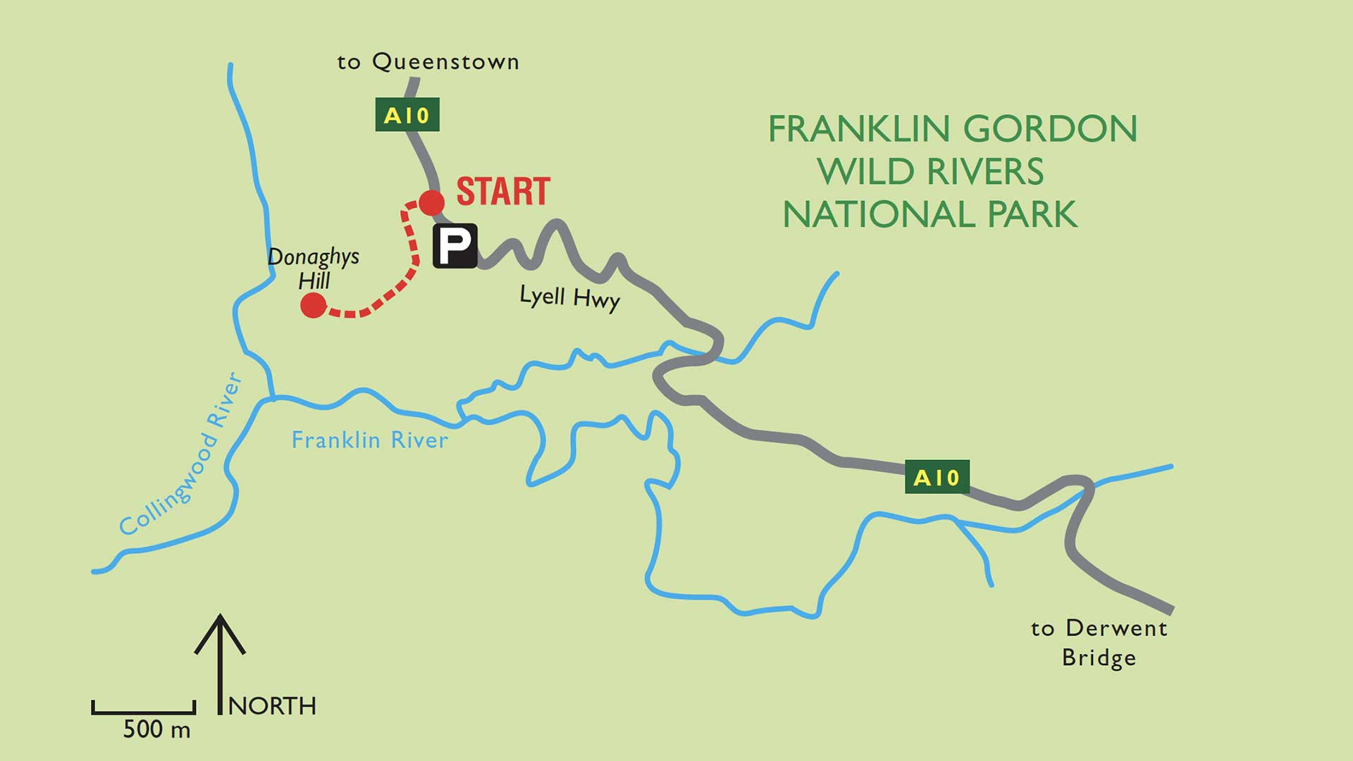
The easy walk to the Donaghy’s Hill lookout platform is only a 40-minute return journey, although you will no doubt spend considerably more time at the lookout taking in the abundant and spectacular views.
The viewing platform on Donaghy’s Hill nestles amongst gum trees on the rocky summit of the hill, and offers a breathtaking 360o panoramic vista of the beautiful Franklin-Gordon Wild Rivers National Park.
From the lookout, you can enjoy superb views of the surrounding hills, which are covered in gum tree forest. As well you will see the wild, Franklin and Collingwood Rivers. The rugged King William Range breaks the southern horizon and you will have no trouble identifying the very aptly named Frenchman’s Cap. At 1446m this is the highest peak in this 440,000-hectare Tasmanian Heritage Park, and is named after its startling resemblance to the Phrygian cap made popular during the French revolution.
Distance from the Lyall Highway (A10) to the top of Donaghy’s Hill (regarded as a small hill) is only 1.1km and is ranked as a level 2 walk. While the track does of course involve a steady climb to the viewing platform, it has a well- graded surface and is considered suitable for most levels of fitness.
Visitors should ensure they have suitable footwear, sun hat, sun block and a light jacket or jersey.
It is not recommended that you walk the track in strong winds or stormy weather.
Pets and firearms are prohibited in the national park and bicycles are not permitted on the track.
Park entry fees DO apply.
Facilities:
Toilet and picnic facilities are located 9kms from Donaghy’s Hill at the Franklin River.
Vehicle Access:
Take the Lyall Highway (A10 from Queenstown or Derwent Bridge. Donaghy’s Hill is situated between the Franklin and Collingwood Rivers.
Leave A Comment